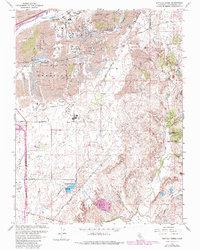
1967 Map of Buffalo Creek
USGS Topo · Published 1980About this map
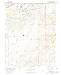
The land around Mather Air Force Base and the U S Military Reservation is defined by a landscape of industrial history and expansive land grants. Extensive Dredge Tailings north of Rebel Hill reflect the legacy of gold mining along the corridor where the Southern Pacific railroad runs parallel to Buffalo Creek. This area preserves the footprints of major historical land divisions, including the boundaries of Rio De Los Americanos and Omochumne, which contrast with the developing mid-century infrastructure of Douglas Road and Jackson Road. Water management is prominent throughout the region, with the Blodgett Reservoir and numerous municipal sites like the Water Treatment Plant and various Sewage Disposal Ponds servicing the growing community. Smaller watercourses such as Laguna Creek, Deer Creek, and Coyote Creek lace through the terrain, while institutions like Carson Creek High Sch appear near the established transportation lines of White Rock Road.
Find a feature on this map
27 named features on this map. Tap any name to fly to it.
Don’t see what you’re looking for? This feature index may not catch every label — zoom into the map to look around manually.
Map Details
Editions of this 1967 Buffalo Creek Map
6 editions found
Other maps of this area

1891 · Sacramento
USGS Topo · 1:125,000

1892 · Sacramento
USGS Topo · 1:125,000

1893 · Sacramento
USGS Topo · 1:125,000

1894 · Lodi
USGS Topo · 1:125,000

1902 · Fairoaks
USGS Topo · 1:62,500

1908 · Buffalo Creek
USGS Topo · 1:31,680

1909 · Elk Grove
USGS Topo · 1:31,680

1909 · Carbondale
USGS Topo · 1:31,680

1909 · Cosumnes
USGS Topo · 1:31,680

1911 · Mills
USGS Topo · 1:31,680