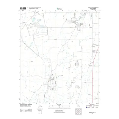
2012 Map of Buffalo Gap
USGS Topo · Published 2012About this map
Buffalo Gap sits at the heart of this landscape, positioned along the banks of Elm Cr just south of the Callahan Divide. This 2012 survey illustrates the transition from the expanding suburban residential blocks of Wylie and Caps in the north to the more open ranching and agricultural terrain of southern Taylor County. The presence of Butterfield School Rd recalls the area's pioneer educational heritage, while the Buffalo Gap Cem and Iberis Cem provide essential anchor points for genealogical research. The geography is defined by narrow creek corridors like Cedar Cr and Cat Claw Cr, which cut through the elevated southern ridges. Modern land use is further evidenced by the Abilene Speedway and the dense grid of county roads and farm-to-market routes that connect the scattered settlements of Cedar Gap and the surrounding prairie.
Find a feature on this map
115 named features on this map. Tap any name to fly to it.
Don’t see what you’re looking for? This feature index may not catch every label — zoom into the map to look around manually.
Map Details
Editions of this 2012 Buffalo Gap Map
This is the sole edition of this map. No revisions or reprints were ever made.
Other maps of this area

1890 · Abilene
USGS Topo · 1:125,000

1892 · Abilene
USGS Topo · 1:125,000

1954 · Abilene
USGS Topo · 1:250,000

1957 · Kirby Lake
USGS Topo · 1:62,500

1957 · Abilene West
USGS Topo · 1:24,000

1957 · Abilene East
USGS Topo · 1:24,000

1957 · Buffalo Gap
USGS Topo · 1:62,500

1958 · Abilene
USGS Topo · 1:250,000

1967 · Tuscola
USGS Topo · 1:24,000
1967 · Lake Abilene
USGS Topo · 1:24,000