
1957 Map of Buffalo Gap
USGS Topo · Published 1958About this map
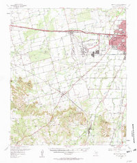
The Callahan Divide defines the southern reach of this mid-century survey, where the rugged uplift gives way to the growing urban footprint of Abilene. Military and academic institutional growth is evident in the 1950s, with Dyess Air Force Base occupying a large military reservation boundary west of the city and McMurry College established within the city limits. A dense network of schools, including Butterfield Sch and Fair Park Sch, serves the emerging suburban and rural communities.
Find a feature on this map
50 named features on this map. Tap any name to fly to it.
Don’t see what you’re looking for? This feature index may not catch every label — zoom into the map to look around manually.
Map Details
Editions of this 1957 Buffalo Gap Map
2 editions found
Other maps of this area

1890 · Abilene
USGS Topo · 1:125,000

1891 · Anson
USGS Topo · 1:125,000

1892 · Abilene
USGS Topo · 1:125,000

1893 · Roby
USGS Topo · 1:125,000

1893 · Anson
USGS Topo · 1:125,000

1893 · Sweetwater
USGS Topo · 1:125,000

1954 · Big Spring
USGS Topo · 1:250,000

1954 · Abilene
USGS Topo · 1:250,000

1957 · Hawley
USGS Topo · 1:62,500

1957 · Merkel
USGS Topo · 1:62,500