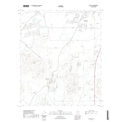
2019 Map of Buffalo Gap
USGS Topo · Published 2019About this map
Buffalo Gap sits at the base of the prominent Callahan Divide, a distinctive uplift that separates the drainages of Elm Cr and Cedar Cr in Taylor County. This late-2010s survey reveals the modern expansion of Abilene south toward Wylie, where residential developments like Pinehurst and names such as Champions Dr signal the suburban transition of the landscape. To the west, the settlement of Caps remains situated near the junction of several rural routes including S FM 707 and Co RD 314.
Find a feature on this map
106 named features on this map. Tap any name to fly to it.
Don’t see what you’re looking for? This feature index may not catch every label — zoom into the map to look around manually.
Map Details
Editions of this 2019 Buffalo Gap Map
This is the sole edition of this map. No revisions or reprints were ever made.
Other maps of this area

1890 · Abilene
USGS Topo · 1:125,000

1892 · Abilene
USGS Topo · 1:125,000

1954 · Abilene
USGS Topo · 1:250,000

1957 · Kirby Lake
USGS Topo · 1:62,500

1957 · Abilene West
USGS Topo · 1:24,000

1957 · Abilene East
USGS Topo · 1:24,000

1957 · Buffalo Gap
USGS Topo · 1:62,500

1958 · Abilene
USGS Topo · 1:250,000

1967 · Tuscola
USGS Topo · 1:24,000
1967 · Lake Abilene
USGS Topo · 1:24,000