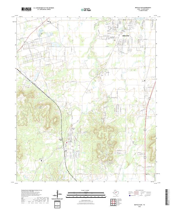
2022 Map of Buffalo Gap
USGS Topo · Published 2022About this map
Buffalo Gap sits at a strategic natural pass through the Callahan Divide in Taylor County, serving as a historic focal point for the region's early development. This survey reveals the transition between the expanding suburban fringes of Abilene and Wylie to the north and the more rugged terrain of the limestone mesas to the south. The landscape is defined by the drainage patterns of Elm Creek and Cedar Creek, which have carved deep relief into the divide. Small rural communities like Caps and Cedar Gap are documented alongside numerous family-history sites, including the Buffalo Gap Cemetery and Iberis Cemetery. The proximity of modern infrastructure such as the Fairways Development Reservoir Number 2 contrasts with long-established local landmarks like Red Hill Tank, illustrating the ongoing evolution of water management and settlement in this part of West Texas.
Find a feature on this map
106 named features on this map. Tap any name to fly to it.
Don’t see what you’re looking for? This feature index may not catch every label — zoom into the map to look around manually.
Map Details
Editions of this 2022 Buffalo Gap Map
This is the sole edition of this map. No revisions or reprints were ever made.
Other maps of this area

1890 · Abilene
USGS Topo · 1:125,000

1892 · Abilene
USGS Topo · 1:125,000

1954 · Abilene
USGS Topo · 1:250,000

1957 · Kirby Lake
USGS Topo · 1:62,500

1957 · Abilene West
USGS Topo · 1:24,000

1957 · Abilene East
USGS Topo · 1:24,000

1957 · Buffalo Gap
USGS Topo · 1:62,500

1958 · Abilene
USGS Topo · 1:250,000

1967 · Tuscola
USGS Topo · 1:24,000
1967 · Lake Abilene
USGS Topo · 1:24,000