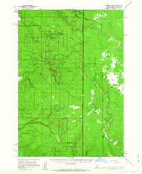
1957 Map of Buffalo Lake
USGS Topo · Published 1963About this map
The Continental Divide winds through this high-altitude landscape, marking a tri-state convergence where Idaho, Montana, and Wyoming meet. Predominantly situated within the Targhee National Forest and Gallatin National Forest, the terrain is defined by broad tablelands like the Moose Creek Plateau and the Madison Plateau. The network of water follows this dramatic geography, with the North Fork, Middle Fork, and South Fork of rivers carving through the timbered slopes.
Find a feature on this map
39 named features on this map. Tap any name to fly to it.
Don’t see what you’re looking for? This feature index may not catch every label — zoom into the map to look around manually.
Map Details
Editions of this 1957 Buffalo Lake Map
2 editions found

Other maps of this area

1885 · Gallatin
USGS Topo · 1:125,000

1885 · Gallatin
USGS Topo · 1:125,000

1886 · Shoshone
USGS Topo · 1:125,000

1888 · Shoshone
USGS Topo · 1:125,000

1895 · Shoshone
USGS Topo · 1:125,000

1901 · Shoshone
USGS Topo · 1:125,000

1901 · Gallatin
USGS Topo · 1:125,000

1908 · Gallatin
USGS Topo · 1:125,000

1908 · Shoshone
USGS Topo · 1:125,000

1911 · Shoshone
USGS Topo · 1:125,000