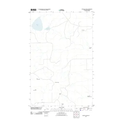
2011 Map of Buffalo Lake
USGS Topo · Published 2011About this map
Buffalo Lake and Little Buffalo Lake anchor the northern landscape of this Glacier County terrain, situated in a region defined by dramatic buttes and coulees. The landform orientation here reveals a series of prominent elevations, including Big Crown Butte, Little Crown Butte, and Antelope Butte, which punctuate the plains. Evidence of local ranching and land use is sparse but significant, centered on the Branderval Ranch and a network of rural routes such as Thorn Rd and Brandvold Rd. Water management and natural drainage patterns are visible through features like Horsethief Ridge and the winding path of Little Rock Coulee, alongside its South Fork. This survey provides a clear view of the high plains topography and isolated landholdings near the Canadian border in the early 21st century.
Find a feature on this map
12 named features on this map. Tap any name to fly to it.
Don’t see what you’re looking for? This feature index may not catch every label — zoom into the map to look around manually.
Map Details
Editions of this 2011 Buffalo Lake Map
This is the sole edition of this map. No revisions or reprints were ever made.
Other maps of this area

1911 · Blackfoot
USGS Topo · 1:125,000

1960 · Cut Bank
USGS Topo · 1:250,000

1963 · Cut Bank
USGS Topo · 1:250,000

1964 · Cut Bank
USGS Topo · 1:250,000

1968 · Buffalo Lake
USGS Topo · 1:24,000

1968 · Rimrock Butte
USGS Topo · 1:24,000
1968 · Love Rock
USGS Topo · 1:24,000

1968 · Rocky Buttes
USGS Topo · 1:24,000
1968 · Fort Piegan
USGS Topo · 1:24,000
1968 · Del Bonita
USGS Topo · 1:24,000