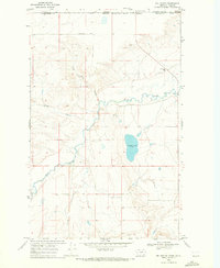
1968 Map of Del Bonita
USGS Topo · Published 1972About this map
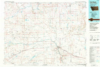
The international border between Canada and the United States defines the geography of this northern Montana landscape, where the Boundary Road separates Montana from Alberta. The settlement of Del Bonita sits at the crossing point, supported by a Canadian Customs post and the nearby Croff Wren Sch. The terrain is shaped by the winding course of the Milk River, which meanders through the central and southern portions of the sheet, fed by glacial drainage features like Kennedy Coulee and Coal Bank Coulee.
Find a feature on this map
14 named features on this map. Tap any name to fly to it.
Don’t see what you’re looking for? This feature index may not catch every label — zoom into the map to look around manually.
Map Details
Editions of this 1968 Del Bonita Map
This is the sole edition of this map. No revisions or reprints were ever made.
Other maps of this area

1911 · Blackfoot
USGS Topo · 1:125,000

1960 · Cut Bank
USGS Topo · 1:250,000

1963 · Cut Bank
USGS Topo · 1:250,000

1964 · Cut Bank
USGS Topo · 1:250,000

1968 · Buffalo Lake
USGS Topo · 1:24,000

1968 · Landslide Butte
USGS Topo · 1:24,000
1968 · Bushnell Hill
USGS Topo · 1:24,000
1968 · Rimrock Ranch
USGS Topo · 1:24,000
1968 · Nightshoot Coulee
USGS Topo · 1:24,000
1984 · Cut Bank
USGS Topo · 1:100,000