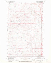
1968 Map of Rimrock Ranch
USGS Topo · Published 1973About this map
The Blackfeet Indian Reservation landscape is defined by the carved drainages of the northern Montana plains as they appeared in the late 1960s. The terrain is dominated by several significant coulees, including Little Rock Coulee, Powell Coulee, and Cobell Coulee, which create a complex network of seasonal watercourses across the high prairie. The named features reflect a ranching and energy-based economy, notably centered around the Rimrock Ranch and a high-pressure Pipeline corridor that traverses the central and eastern portions of the quadrangle. Numerous unidentified Spring and Springs locations are scattered throughout the draws, indicating vital water sources in this semi-arid region near Harwood. This 1968 field-checked survey provides a meticulous record of the natural topography and the sparse human infrastructure within the reservation boundary.
Find a feature on this map
8 named features on this map. Tap any name to fly to it.
Don’t see what you’re looking for? This feature index may not catch every label — zoom into the map to look around manually.
Map Details
Editions of this 1968 Rimrock Ranch Map
This is the sole edition of this map. No revisions or reprints were ever made.
Other maps of this area

1911 · Blackfoot
USGS Topo · 1:125,000

1960 · Cut Bank
USGS Topo · 1:250,000

1963 · Cut Bank
USGS Topo · 1:250,000

1964 · Cut Bank
USGS Topo · 1:250,000

1968 · Buffalo Lake
USGS Topo · 1:24,000

1968 · Rimrock Butte
USGS Topo · 1:24,000
1968 · Fort Piegan
USGS Topo · 1:24,000
1968 · Del Bonita
USGS Topo · 1:24,000
1968 · Sharp Lake
USGS Topo · 1:24,000

1968 · Landslide Butte
USGS Topo · 1:24,000