
1954 Map of Buffalo Mtn
USGS Topo · Published 1956About this map
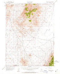
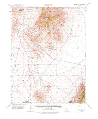
Mining and high-desert transit define this mid-century survey of the Nevada interior, where the Old Emigrant Jeep Trail cuts across the arid floor of Buena Vista Valley. The landscape is dominated by the steep rises of Buffalo Mtn and Cornish Peak, separated by a series of rugged drainage systems like Relief Canyon and Willow Creek Canyon. This era was marked by active mercury extraction, evidenced by the presence of the Nevada Quicksilver Mine and the Pershing Quicksilver Mine situated along the slopes of the Antelope Range. Isolated landmarks like the Airway Beacon and various Windmill sites reflect the region's role as a waypoint for both early transcontinental flight paths and local ranching. Water sources are sparse but critical, with Black Knob Spring and Buffalo Springs serving as vital anchors in a territory otherwise defined by dry washes and mineral prospects like the Green Gold Mine.
Find a feature on this map
31 named features on this map. Tap any name to fly to it.
Don’t see what you’re looking for? This feature index may not catch every label — zoom into the map to look around manually.
Map Details
Editions of this 1954 Buffalo Mtn Map
3 editions found
Other maps of this area

1908 · Carson Sink
USGS Topo · 1:250,000

1910 · Carson Sink
USGS Topo · 1:250,000

1931 · Lovelock
USGS Topo · 1:250,000

1932 · Sonoma Range
USGS Topo · 1:250,000

1935 · Lovelock
USGS Topo · 1:250,000

1939 · Sonoma Range
USGS Topo · 1:250,000

1954 · Unionville
USGS Topo · 1:62,500

1955 · Millett
USGS Topo · 1:250,000

1955 · Lovelock
USGS Topo · 1:250,000

1955 · Winnemucca
USGS Topo · 1:250,000