
1965 Map of Buffalo NW
USGS Topo · Published 1967About this map
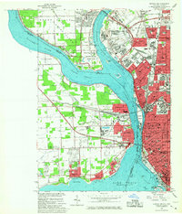
Niagara River frontage and international border crossings define this mid-1960s view of the Buffalo metropolitan area. The map captures the dense urban grid of Buffalo and Kenmore, featuring a high concentration of institutional landmarks including State University College, St Josephs Cathedral, and several namesake public schools. Across the Chippawa Channel, the southern end of Grand Island is shown transitioning from open land to suburban development, anchored by the Grand Island Airport and the expansive Beaver Island State Park.
Find a feature on this map
122 named features on this map. Tap any name to fly to it.
Don’t see what you’re looking for? This feature index may not catch every label — zoom into the map to look around manually.
Map Details
Editions of this 1965 Buffalo NW Map
2 editions found
Other maps of this area

1894 · Buffalo
USGS Topo · 1:62,500

1894 · Niagara Falls
USGS Topo · 1:62,500

1896 · Niagara Falls
USGS Topo · 1:62,500

1897 · Tonawanda
USGS Topo · 1:62,500

1899 · Niagara
USGS Topo · 1:125,000

1900 · Tonawanda
USGS Topo · 1:62,500

1900 · Niagara Falls
USGS Topo · 1:62,500

1901 · Buffalo
USGS Topo · 1:62,500

1901 · Niagara Falls
USGS Topo · 1:62,500

1901 · Tonawanda
USGS Topo · 1:62,500