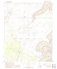
1988 Map of Buffalo Ranch
USGS Topo · Published 1988About this map
The Buffalo Ranch settlement and its adjacent Landing Strip serve as a remote outpost in this 1980s landscape, situated where the high desert plateau meets the dramatic descent of the canyon systems. The map illustrates a complex intersection of land management and natural boundaries, showing the Kaibab National Forest and the Grand Canyon National Game Preserve bordering the Navajo Indian Reservation.
Find a feature on this map
29 named features on this map. Tap any name to fly to it.
Don’t see what you’re looking for? This feature index may not catch every label — zoom into the map to look around manually.
Map Details
Editions of this 1988 Buffalo Ranch Map
2 editions found
Other maps of this area

1886 · Echo Cliffs
USGS Topo · 1:250,000

1886 · Kaibab
USGS Topo · 1:250,000

1891 · Echo Cliffs
USGS Topo · 1:250,000

1936 · Jacobs Lake
USGS Topo · 1:48,000

1940 · Jacob Lake
USGS Topo · 1:62,500

1953 · Jacobs Lake
USGS Topo · 1:62,500

1953 · Grand Canyon
USGS Topo · 1:250,000

1954 · Nankoweap
USGS Topo · 1:62,500

1954 · Emmett Wash
USGS Topo · 1:62,500

1956 · Marble Canyon
USGS Topo · 1:250,000