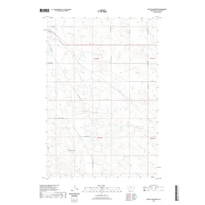
2020 Map of Buffalo Reservoir
USGS Topo · Published 2020About this map
Buffalo Reservoir sits at the heart of this high-plains landscape in Fallon County, where seasonal drainage ways like Buffalo Cr and Corral Cr carve through the prairie. The geography is defined by isolated topographic rises, most notably Bracket Butte, and a network of rural roads that hint at the region's agricultural and social history, such as Dance Hall Rd and Fertile Prairie Rd. Near the northwest corner, the Baker Municipal Airport serves as a modern waypoint, while the rest of the quadrangle remains dominated by the sprawling reaches of the Sandstone Cr watershed. This 2020 survey illustrates how local land use is organized around vital water sources and the township-range system, reflecting the enduring cattle-and-grain character of eastern Montana.
Find a feature on this map
26 named features on this map. Tap any name to fly to it.
Don’t see what you’re looking for? This feature index may not catch every label — zoom into the map to look around manually.
Map Details
Editions of this 2020 Buffalo Reservoir Map
This is the sole edition of this map. No revisions or reprints were ever made.
Other maps of this area

1953 · Miles City
USGS Topo · 1:250,000

1957 · Miles City
USGS Topo · 1:250,000

1958 · Miles City
USGS Topo · 1:250,000

1981 · Webster NW
USGS Topo · 1:24,000

1981 · Baker
USGS Topo · 1:100,000

1981 · Baker NE
USGS Topo · 1:24,000

1981 · Buffalo Reservoir
USGS Topo · 1:24,000

1981 · Baker
USGS Topo · 1:24,000

1981 · Willard
USGS Topo · 1:24,000
1981 · Morris Butte
USGS Topo · 1:24,000