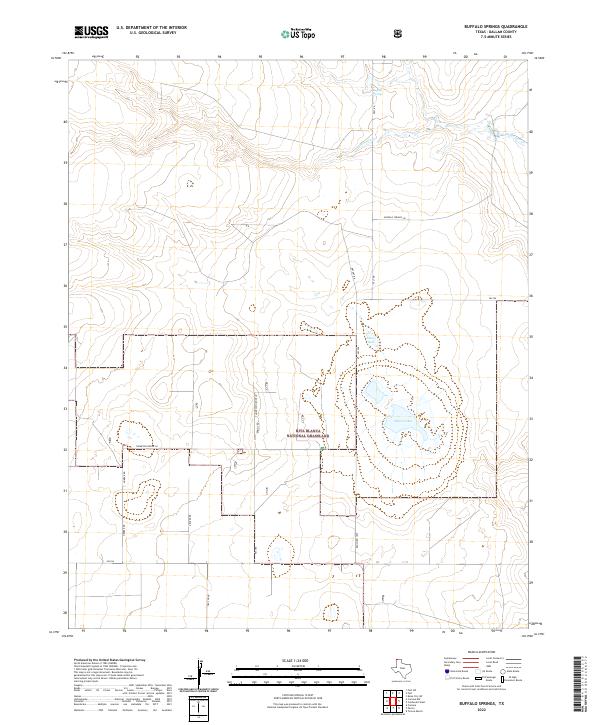
2022 Map of Buffalo Springs
USGS Topo · Published 2022About this map
Rita Blanca National Grassland dominates the southern landscape of this Dallam County region, highlighting the vast conservation efforts in the Texas Panhandle. The northern portion is defined by the winding course of Coldwater Creek and the eponymous Buffalo Springs. The terrain is characterized by its hydrologic features, including Alkali Lakes and Flater Lake, which suggest the seasonal and mineral-rich nature of the high plains water table. A sparse network of local roads such as Herber Rd and Decker Rd provides access to these grasslands. This map captures the remote character of the borderlands where Northwest Texas meets the Oklahoma Panhandle, showing a landscape primarily managed for conservation and ranching infrastructure.
Find a feature on this map
14 named features on this map. Tap any name to fly to it.
Don’t see what you’re looking for? This feature index may not catch every label — zoom into the map to look around manually.
Map Details
Editions of this 2022 Buffalo Springs Map
This is the sole edition of this map. No revisions or reprints were ever made.
Other maps of this area

1954 · Dalhart
USGS Topo · 1:250,000

1958 · Dalhart
USGS Topo · 1:250,000

1962 · Dalhart
USGS Topo · 1:250,000

1969 · Felt SW
USGS Topo · 1:24,000

1969 · Boise City SW
USGS Topo · 1:24,000

1969 · Felt
USGS Topo · 1:24,000

1973 · Buffalo Springs
USGS Topo · 1:24,000

1973 · Tovrea Ranch
USGS Topo · 1:24,000

1973 · Corlena
USGS Topo · 1:24,000

1973 · Perico
USGS Topo · 1:24,000