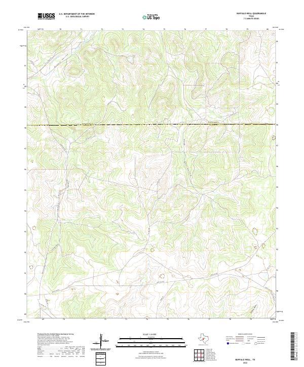
2022 Map of Buffalo Well
USGS Topo · Published 2022About this map
Schleicher Co Sutton Co boundary lines divide this high-plains landscape, where the drainage systems of the Edwards Plateau dictate the movement of roads and property lines. The topography is defined by the headwaters of Middle Valley Prong and the intermittent flow of Buffalo Draw, which carve shallow relief into the limestone-based terrain. This area is predominantly ranch land, reflected in the network of private and county routes like Baker Rd and Ranch Rd 864 that connect isolated properties. Industrial footprints are visible through the path of Old Pipeline Rd, cutting across the natural contours of Middle Valley and Bull Hollow. The map captures a contemporary look at rural land use in West Texas, where large-scale ranching and energy infrastructure remain the primary drivers of the local geography.
Find a feature on this map
21 named features on this map. Tap any name to fly to it.
Don’t see what you’re looking for? This feature index may not catch every label — zoom into the map to look around manually.
Map Details
Editions of this 2022 Buffalo Well Map
This is the sole edition of this map. No revisions or reprints were ever made.
Other maps of this area

1893 · Fort McKavett
USGS Topo · 1:125,000

1954 · Sonora
USGS Topo · 1:250,000

1958 · Sonora
USGS Topo · 1:250,000

1963 · Buffalo Well
USGS Topo · 1:24,000

1963 · Buffalo Well NW
USGS Topo · 1:24,000

1963 · Buffalo Well SE
USGS Topo · 1:24,000

1963 · Adams SE
USGS Topo · 1:24,000
1963 · Brokeleg Mountain
USGS Topo · 1:24,000

1963 · Buffalo Well SW
USGS Topo · 1:24,000

1963 · Adams SW
USGS Topo · 1:24,000