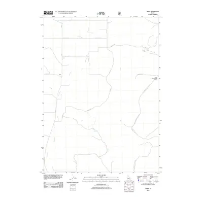
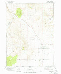
2011 Map of Buist
USGS Topo · Published 2011About this map
Buist occupies a high-elevation drainage where local transit networks meet at the crossroads of Buist Rd and N Arbon Valley Rd. This upland Idaho landscape is defined by the headwaters of Deep Creek and Bannock Creek, which carve through the terrain as it rises toward the eastern peaks. The map details a complex system of canyon routes and passes, including Jensen Pass and the winding South Fork Sublette Canyon, which likely served as vital connectors for ranching or transport in this sparsely settled region. Evidence of essential water sources for livestock or early settlers is found in the locations of Petit Spring and Taylor Spring. A grid of named thoroughfares like N Bull Canyon Rd and Old Sublette Rd reveals how modern infrastructure follows the natural contours of the canyons and ridgelines.
Find a feature on this map
21 named features on this map. Tap any name to fly to it.
Don’t see what you’re looking for? This feature index may not catch every label — zoom into the map to look around manually.
Map Details
Editions of this 2011 Buist Map
This is the sole edition of this map. No revisions or reprints were ever made.
Other maps of this area

1954 · Pocatello
USGS Topo · 1:250,000

1958 · Pocatello
USGS Topo · 1:250,000

1963 · Daniels
USGS Topo · 1:24,000

1968 · Ireland Springs
USGS Topo · 1:24,000

1968 · Daniels
USGS Topo · 1:24,000

1968 · Dairy Creek
USGS Topo · 1:24,000
1973 · Arbon
USGS Topo · 1:24,000
1973 · Sheep Creek Spring
USGS Topo · 1:24,000
1973 · Deep Creek Peak
USGS Topo · 1:24,000
1973 · Holbrook
USGS Topo · 1:24,000