2021 Map of Buldier Island B-1 SE
USGS Topo · Published 2021About this map
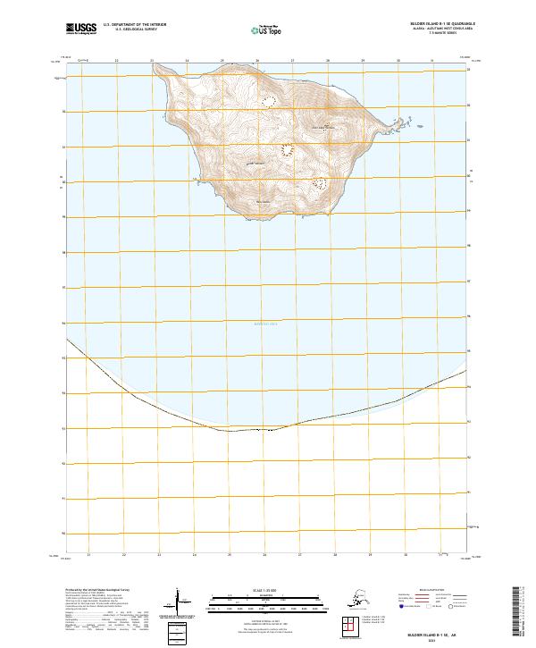
Buldir Volcano dominates this isolated volcanic landscape within the Rat Islands group, rising steeply from the waters of the Bering Sea. The terrain is characterized by its geological activity, with the prominent East Cape Volcano marking the eastern reaches of the landmass. This 2021 survey illustrates the stark, uninhabited nature of the Aleutian chain, where the land is defined entirely by its two volcanic peaks. The lack of human infrastructure or named settlements emphasizes the role of these islands as critical navigational markers and biological refuges in a maritime environment. Topographical contours detail the sharp elevation gains from the shoreline to the volcanic summits, providing a clear view of the island's primary landforms as they existed at the start of the 2020s.
Find a feature on this map
6 named features on this map. Tap any name to fly to it.
Don’t see what you’re looking for? This feature index may not catch every label — zoom into the map to look around manually.
Map Details
Editions of this 2021 Buldier Island B-1 SE Map
This is the sole edition of this map. No revisions or reprints were ever made.