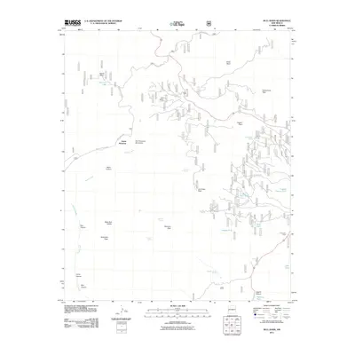
2011 Map of Bull Basin
USGS Topo · Published 2011About this map
Aspen Mountain and the San Francisco Mountains dominate this high-elevation landscape in the Gila National Forest area. The terrain is defined by a series of prominent summits including Leggett Peak, Joe Green Peak, and Maverick Peak, separated by steep-walled drainages such as Ward Canyon and Bull Canyon. Settlement is sparse, characterized by functional outposts like Pine Lawn Camp and Jones Corral, suggesting a region primarily utilized for ranching and seasonal forestry activities.
Find a feature on this map
39 named features on this map. Tap any name to fly to it.
Don’t see what you’re looking for? This feature index may not catch every label — zoom into the map to look around manually.
Map Details
Editions of this 2011 Bull Basin Map
This is the sole edition of this map. No revisions or reprints were ever made.
Other maps of this area

1915 · Reserve
USGS Topo · 1:125,000

1918 · Reserve
USGS Topo · 1:125,000

1922 · Nutrioso
USGS Topo · 1:125,000

1954 · Clifton
USGS Topo · 1:250,000

1957 · Clifton
USGS Topo · 1:250,000

1958 · Clifton
USGS Topo · 1:250,000

1958 · Alpine
USGS Topo · 1:62,500

1961 · Blue
USGS Topo · 1:62,500

1962 · Clifton
USGS Topo · 1:250,000
1963 · Saliz Pass
USGS Topo · 1:24,000