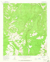
1963 Map of Saliz Pass
USGS Topo · Published 1965About this map
Brushy Mountains and the Saliz Mountains dominate this 1963 survey of the high country within the Gila National Forest. The landscape is defined by a complex network of canyons and mesas, with Saliz Pass serving as a primary transit point. Evidence of ranching and early habitation is scattered throughout the drainages, including Martinez Ranch in the north and L Kelly Ranch near the San Francisco River in the southeast. Small-scale resource extraction and livestock management are indicated by the Saliz No 2 mine and various water improvements like Ribbon Tank, Willies Tank, and the humorously named Gut Ache Mesa Tank. A primitive Jeep Trail winds through the hills, connecting isolated outposts like Kelly Camp to the larger canyon systems of Pueblo Creek and Saliz Canyon.
Find a feature on this map
42 named features on this map. Tap any name to fly to it.
Don’t see what you’re looking for? This feature index may not catch every label — zoom into the map to look around manually.
Map Details
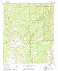
Editions of this 1963 Saliz Pass Map
2 editions found
Other maps of this area

1910 · Mogollon
USGS Topo · 1:125,000

1912 · Mogollon
USGS Topo · 1:125,000

1913 · Morenci
USGS Topo · 1:125,000

1915 · Morenci
USGS Topo · 1:125,000

1915 · Reserve
USGS Topo · 1:125,000

1918 · Reserve
USGS Topo · 1:125,000

1922 · Nutrioso
USGS Topo · 1:125,000

1954 · Clifton
USGS Topo · 1:250,000

1957 · Clifton
USGS Topo · 1:250,000

1958 · Clifton
USGS Topo · 1:250,000