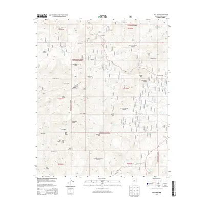
2013 Map of Bull Basin
USGS Topo · Published 2013About this map
Aspen Mountain and the San Francisco Mountains dominate this high-country landscape where the boundaries of the Apache National Forest and Gila National Forest converge. The terrain is defined by a dense network of drainages and named summits, including Black Bull Peak and Joe Green Peak, reflecting a landscape managed for timber and grazing. Cultural markers like Leggett Cabin Spring and several livestock water features such as Leggett Tank and Bluff Tank indicate a long-standing ranching presence in the region. Transportation is anchored by US Hwy 180, which winds through the canyons and draws, while an intricate system of forest roads, such as Pueblo Park Rd, provides access to more remote locations like Horse Mesa and the aptly named Dangerous Park Canyon.
Find a feature on this map
62 named features on this map. Tap any name to fly to it.
Don’t see what you’re looking for? This feature index may not catch every label — zoom into the map to look around manually.
Map Details
Editions of this 2013 Bull Basin Map
This is the sole edition of this map. No revisions or reprints were ever made.
Other maps of this area

1915 · Reserve
USGS Topo · 1:125,000

1918 · Reserve
USGS Topo · 1:125,000

1922 · Nutrioso
USGS Topo · 1:125,000

1954 · Clifton
USGS Topo · 1:250,000

1957 · Clifton
USGS Topo · 1:250,000

1958 · Clifton
USGS Topo · 1:250,000

1958 · Alpine
USGS Topo · 1:62,500

1961 · Blue
USGS Topo · 1:62,500

1962 · Clifton
USGS Topo · 1:250,000
1963 · Saliz Pass
USGS Topo · 1:24,000