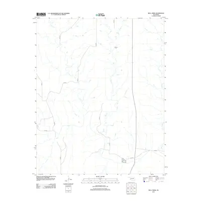
2012 Map of Bull Creek
USGS Topo · Published 2012About this map
Vannerson Cem serves as a quiet historical anchor in this rural portion of Beckham County, where the landscape is defined by the branching tributaries of the Red River watershed. The geography is dominated by the meandering paths of Bull Cr, Elm Cr, and N Elm Cr, which carve through the plains and dictate the local road network. The map reveals a sparse, high-plains settlement pattern where section-line roads like n1700 RD and n1710 RD provide the primary framework for movement. While modern infrastructure is present, the layout of these rural routes and the persistence of family-named sites like the cemetery offer a clear view of the area's agricultural heritage and the enduring relationship between water sources and land division in western Oklahoma.
Find a feature on this map
19 named features on this map. Tap any name to fly to it.
Don’t see what you’re looking for? This feature index may not catch every label — zoom into the map to look around manually.
Map Details
Editions of this 2012 Bull Creek Map
This is the sole edition of this map. No revisions or reprints were ever made.
Other maps of this area

1954 · Amarillo
USGS Topo · 1:250,000

1954 · Plainview
USGS Topo · 1:250,000

1955 · Lawton
USGS Topo · 1:250,000

1955 · Clinton
USGS Topo · 1:250,000

1957 · Clinton
USGS Topo · 1:250,000

1958 · Amarillo
USGS Topo · 1:250,000

1958 · Plainview
USGS Topo · 1:250,000

1959 · Shinnery Creek
USGS Topo · 1:24,000

1961 · Erick
USGS Topo · 1:62,500

1963 · Fulller
USGS Topo · 1:24,000