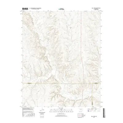
2016 Map of Bull Creek
USGS Topo · Published 2016About this map
Vannerson Cem serves as a quiet historical anchor in this section of southwestern Oklahoma, where the terrain is defined by the drainage systems of Bull Cr and its tributaries. The landscape is marked by a complex network of section-line roads, including n1700 RD and d1673 RD, which navigate the eroded breaks leading toward Elm Cr. A unique jurisdictional junction occurs here, as the map captures the meeting point of three counties: Beckham, Harmon, and Greer.
Find a feature on this map
15 named features on this map. Tap any name to fly to it.
Don’t see what you’re looking for? This feature index may not catch every label — zoom into the map to look around manually.
Map Details
Editions of this 2016 Bull Creek Map
This is the sole edition of this map. No revisions or reprints were ever made.
Other maps of this area

1954 · Amarillo
USGS Topo · 1:250,000

1954 · Plainview
USGS Topo · 1:250,000

1955 · Lawton
USGS Topo · 1:250,000

1955 · Clinton
USGS Topo · 1:250,000

1957 · Clinton
USGS Topo · 1:250,000

1958 · Amarillo
USGS Topo · 1:250,000

1958 · Plainview
USGS Topo · 1:250,000

1959 · Shinnery Creek
USGS Topo · 1:24,000

1961 · Erick
USGS Topo · 1:62,500

1963 · Fulller
USGS Topo · 1:24,000