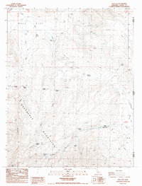
1988 Map of Bull Flat
USGS Topo · Published 1989About this map
Skedaddle Mountains dominate this high-desert landscape in northeastern California, marking a rugged transition near the Nevada state line. This late-1980s topography reveals a remote territory defined by its water sources, with numerous named springs such as Rag House Spring and Tin House Spring providing essential resources for the Skedaddle Ranch and the transient Bull Flat Camp. The presence of these named camps and springs suggests a history of cattle ranching and seasonal occupation in the shadow of Hot Springs Peak.
Find a feature on this map
27 named features on this map. Tap any name to fly to it.
Don’t see what you’re looking for? This feature index may not catch every label — zoom into the map to look around manually.
Map Details
Editions of this 1988 Bull Flat Map
This is the sole edition of this map. No revisions or reprints were ever made.
Other maps of this area

1886 · Honey Lake
USGS Topo · 1:250,000

1886 · Granite Range
USGS Topo · 1:250,000

1891 · Honey Lake
USGS Topo · 1:250,000

1893 · Honey Lake
USGS Topo · 1:250,000

1894 · Granite Range
USGS Topo · 1:250,000

1954 · Wendel
USGS Topo · 1:62,500

1954 · Shinn Mountain
USGS Topo · 1:62,500

1955 · Westwood
USGS Topo · 1:250,000

1955 · Lovelock
USGS Topo · 1:250,000

1958 · Westwood
USGS Topo · 1:250,000