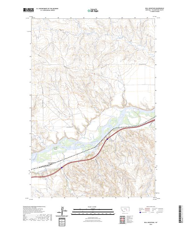
2024 Map of Bull Mountain
USGS Topo · Published 2024About this map
The Yellowstone River snakes through this portion of Yellowstone County, defining a landscape shaped by water and agricultural engineering. In the valley floor, the Huntley Main Canal runs parallel to the river, a critical piece of infrastructure for local irrigation that skirts the base of the rising northern slopes. The topography is characterized by a series of distinct drainages such as Hibbard Creek, Kaiser Creek, and Rough Coulee that feed into the river system. The small settlement of Bull Mountain is situated in the southwestern section of the map, connected to the surrounding countryside by a network of rural routes including Bull Mountain Rd and Custer Frontage Rd. Landforms like Randalls Island sit within the river’s path, while the northern uplands are accessed by long stretches like Seven Mile Flat Rd.
Find a feature on this map
21 named features on this map. Tap any name to fly to it.
Don’t see what you’re looking for? This feature index may not catch every label — zoom into the map to look around manually.
Map Details
Editions of this 2024 Bull Mountain Map
This is the sole edition of this map. No revisions or reprints were ever made.
Other maps of this area

1894 · Fort Custer
USGS Topo · 1:125,000

1954 · Hardin
USGS Topo · 1:250,000

1954 · Forsyth
USGS Topo · 1:250,000

1957 · Hardin
USGS Topo · 1:250,000

1957 · Forsyth
USGS Topo · 1:250,000

1958 · Forsyth
USGS Topo · 1:250,000

1958 · Hardin
USGS Topo · 1:250,000

1960 · Coal Bank Creek
USGS Topo · 1:24,000
1960 · Lemon Ranch
USGS Topo · 1:24,000

1960 · Waco
USGS Topo · 1:24,000