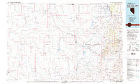
1982 Map of Bull Run Mts
USGS Topo · Published 1982About this map
Mining operations and high desert ranching define this 1980s landscape across the Idaho Nevada state line. The Bull Run Mountains dominate the eastern portion of the map, sheltering a cluster of historical mineral claims such as the Cornucopia Mine, Pennsylvania Mine, and Blue Jacket Mine near the settlement of Edgemont. Further south, the town of Tuscarora sits on the edge of the Owyhee Desert, representing a legacy of late 19th-century silver and gold rushes that shaped Elko County.
Find a feature on this map
55 named features on this map. Tap any name to fly to it.
Don’t see what you’re looking for? This feature index may not catch every label — zoom into the map to look around manually.
Map Details
Editions of this 1982 Bull Run Mts Map
2 editions found

Other maps of this area

1882 · Paradise
USGS Topo · 1:250,000

1893 · Paradise
USGS Topo · 1:250,000

1936 · Mountain City
USGS Topo · 1:62,500

1939 · Owyhee
USGS Topo · 1:62,500

1940 · Mountain City
USGS Topo · 1:62,500

1942 · Owyhee
USGS Topo · 1:62,500

1955 · McDermitt
USGS Topo · 1:250,000

1955 · Jordan Valley
USGS Topo · 1:250,000

1955 · Twin Falls
USGS Topo · 1:250,000

1955 · Wells
USGS Topo · 1:250,000