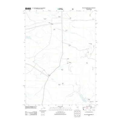
2012 Map of Bull Run Reservoir
USGS Topo · Published 2012About this map
Echo sits at the heart of this high-desert ranching landscape in northern Elko County, where the legacy of early communication and transport is preserved through several historic locations. The map documents numerous remote mail points, including White Rock Post Office, Excelsior Post Office, and Edgemont Post Office, reflecting a time when isolated homesteads and mining camps relied on these decentralized hubs. The drainage of Bull Run feeds into the Bull Run Reservoir at the southern edge of the sheet, a vital water management feature for the region's arid environment.
Find a feature on this map
30 named features on this map. Tap any name to fly to it.
Don’t see what you’re looking for? This feature index may not catch every label — zoom into the map to look around manually.
Map Details
Editions of this 2012 Bull Run Reservoir Map
This is the sole edition of this map. No revisions or reprints were ever made.
Other maps of this area

1939 · Owyhee
USGS Topo · 1:62,500

1942 · Owyhee
USGS Topo · 1:62,500

1955 · McDermitt
USGS Topo · 1:250,000

1956 · Bull Run
USGS Topo · 1:62,500

1959 · McDermitt
USGS Topo · 1:250,000

1964 · Hat Peak
USGS Topo · 1:62,500

1964 · Wilson Reservoir
USGS Topo · 1:62,500
1970 · Ungina Wongo
USGS Topo · 1:24,000
1971 · Dry Creek Reservoir
USGS Topo · 1:24,000

1982 · Bull Run Mts
USGS Topo · 1:100,000