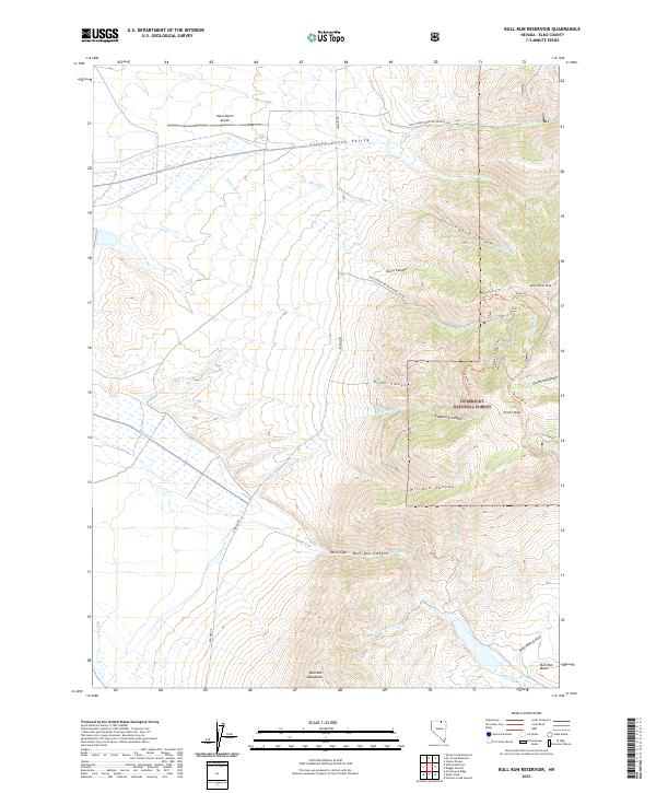
2021 Map of Bull Run Reservoir
USGS Topo · Published 2021About this map
Silver Creek Valley and the northern reaches of the Bull Run Mountains dominate this high-desert landscape in Elko County. The map details a transition from the level ranching lands near the Petan Ranch Airport to the steep, canyon-cut terrain of the Humboldt National Forest. This area is defined by its drainages, including Silver Cr and White Rock Cr, which carve through prominent heights like Porter Peak and Blue Jacket Peak. A network of Forest Service roads and trails, such as the Edgemont Trl and White Rock Creek Road, provide access to the interior canyons. The presence of California Gulch and Edgemont Canyon points to the region's historical mining and ranching activity, while the southeastern corner reveals the natural bowl of the Bull Run Basin.
Find a feature on this map
40 named features on this map. Tap any name to fly to it.
Don’t see what you’re looking for? This feature index may not catch every label — zoom into the map to look around manually.
Map Details
Editions of this 2021 Bull Run Reservoir Map
This is the sole edition of this map. No revisions or reprints were ever made.
Other maps of this area

1939 · Owyhee
USGS Topo · 1:62,500

1942 · Owyhee
USGS Topo · 1:62,500

1955 · McDermitt
USGS Topo · 1:250,000

1956 · Bull Run
USGS Topo · 1:62,500

1959 · McDermitt
USGS Topo · 1:250,000

1964 · Hat Peak
USGS Topo · 1:62,500

1964 · Wilson Reservoir
USGS Topo · 1:62,500
1970 · Ungina Wongo
USGS Topo · 1:24,000
1971 · Dry Creek Reservoir
USGS Topo · 1:24,000

1982 · Bull Run Mts
USGS Topo · 1:100,000