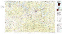
1985 Map of Bull Shoals Lake
USGS Topo · Published 1985About this map
Bull Shoals Lake and Norfork Lake dominate this mid-1980s landscape of the Ozarks, their sprawling shorelines defined by the damming of the White River and North Fork River. This period shows a region transitioning from isolated highland farming and mining toward its modern identity as a water-recreation hub. The Missouri Pacific RR corridor through Pyatt, Yellville, and Cotter illustrates the historical transport backbone that once moved minerals and timber from the interior. Traceable relics of earlier industry include the Lost Bell Mine and scattered gravel pits, while numerous schools and cemeteries mark the legacy of rural communities such as Dodd City, Monarch, and Everton. Protected areas like the Sylamore State Wildlife Management Area and the Ozark National Forest underscore the persistent wilderness character of the Buffalo River corridor.
Find a feature on this map
77 named features on this map. Tap any name to fly to it.
Don’t see what you’re looking for? This feature index may not catch every label — zoom into the map to look around manually.
Map Details
Editions of this 1985 Bull Shoals Lake Map
This is the sole edition of this map. No revisions or reprints were ever made.
Other maps of this area

1890 · Batesville
USGS Topo · 1:125,000

1890 · Mountain Home
USGS Topo · 1:125,000

1891 · Mountain Home
USGS Topo · 1:125,000

1891 · Batesville
USGS Topo · 1:125,000

1892 · Marshall
USGS Topo · 1:125,000

1892 · Mountain View
USGS Topo · 1:125,000

1893 · Yellville
USGS Topo · 1:125,000

1894 · Mountain View
USGS Topo · 1:125,000

1894 · Mountain Home
USGS Topo · 1:125,000

1894 · Marshall
USGS Topo · 1:125,000