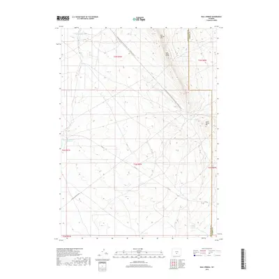
2018 Map of Bull Springs
USGS Topo · Published 2018About this map
The Continental Divide National Scenic Trail: Wyoming Portion cuts diagonally across this high-desert landscape in Sweetwater County, following the natural heights of the Lost Soldier Divide. The terrain is defined by dramatic escarpments like Bull Springs Rim and Coyote Springs Rim, which overlook a network of ephemeral drainages and vital water sources. Management of water in this arid environment is evident through the Upper Water Stewart Cr Reservoir and Lower Water Stewart Cr Reservoir along Stewart Cr. The presence of Minerals Exploration Rd and Co Rd 63 indicates the modern industrial and ranching uses of the land. Small reliable water points, such as Bull Springs and Coyote Spring, remain critical landmarks in a region where the high plains meet the divide.
Find a feature on this map
19 named features on this map. Tap any name to fly to it.
Don’t see what you’re looking for? This feature index may not catch every label — zoom into the map to look around manually.
Map Details
Editions of this 2018 Bull Springs Map
This is the sole edition of this map. No revisions or reprints were ever made.
Other maps of this area

1954 · Rawlins
USGS Topo · 1:250,000

1955 · Casper
USGS Topo · 1:250,000

1956 · Rawlins Peak
USGS Topo · 1:62,500

1958 · Rawlins
USGS Topo · 1:250,000

1958 · Casper
USGS Topo · 1:250,000

1960 · Larsen Knoll
USGS Topo · 1:24,000

1960 · Separation Rim
USGS Topo · 1:24,000

1960 · Bull Springs
USGS Topo · 1:24,000

1960 · Buck Draw
USGS Topo · 1:24,000

1960 · Chicken Spring
USGS Topo · 1:24,000