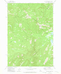
1972 Map of Bull Trout Point
USGS Topo · Published 1975About this map
Boise National Forest and Challis National Forest converge at this high-altitude intersection of Valley, Boise, and Custer Counties in the early 1970s. The landscape is defined by an intricate network of drainages and peaks, with Bull Trout Lake and its surrounding campgrounds serving as a primary focal point for human activity. Evidence of earlier exploration remains visible through scattered prospects located near the ridge west of Bull Trout Point. Transport through this wilderness relies on a system of rugged paths, including an extensive Pack Trail that follows the contours of the mountain ridges. The hydrology of the region is exceptionally detailed, featuring the headwaters of Pole Creek, Dead Man Creek, and the uniquely named No Name Creek, which feed into the larger river systems of the central Idaho interior.
Find a feature on this map
18 named features on this map. Tap any name to fly to it.
Don’t see what you’re looking for? This feature index may not catch every label — zoom into the map to look around manually.
Map Details
Editions of this 1972 Bull Trout Point Map
2 editions found
Other maps of this area

1891 · Bear Valley
USGS Topo · 1:125,000

1893 · Bear Valley
USGS Topo · 1:125,000

1957 · Challis
USGS Topo · 1:250,000

1960 · Challis
USGS Topo · 1:250,000

1963 · Challis
USGS Topo · 1:250,000

1972 · Bull Trout Point
USGS Topo · 1:24,000
1972 · Banner Summit
USGS Topo · 1:24,000

1972 · Cache Creek
USGS Topo · 1:24,000
1972 · Miller Mtn East
USGS Topo · 1:24,000
1972 · Eightmile Mtn
USGS Topo · 1:24,000