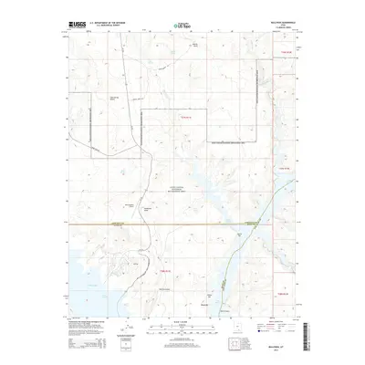
2014 Map of Bullfrog
USGS Topo · Published 2014About this map
Lake Powell dominates the southern half of this landscape, its fingers reaching into Glen Canyon at the intersection of Garfield, Kane, and San Juan counties. The hub of Bullfrog serves as a primary access point for the Glen Canyon National Recreation Area, supported by the Bullfrog Basin Airport and the north-south corridor of Ut-276. Away from the water's edge, the terrain ascends into the arid reaches of the Cane Spring Desert and the prominent Hoskinnini Mesa.
Find a feature on this map
31 named features on this map. Tap any name to fly to it.
Don’t see what you’re looking for? This feature index may not catch every label — zoom into the map to look around manually.
Map Details
Editions of this 2014 Bullfrog Map
This is the sole edition of this map. No revisions or reprints were ever made.
Other maps of this area

1886 · Henry Mountains
USGS Topo · 1:250,000

1892 · Henry Mountains
USGS Topo · 1:250,000

1953 · Mt Pennell 4 NE
USGS Topo · 1:24,000

1953 · The Rincon
USGS Topo · 1:62,500

1953 · Lake Canyon
USGS Topo · 1:62,500

1953 · Mt. Ellsworth
USGS Topo · 1:62,500

1953 · Hall Mesa
USGS Topo · 1:62,500

1956 · Escalante
USGS Topo · 1:250,000

1960 · Escalante
USGS Topo · 1:250,000
1980 · Hite Crossing
USGS Topo · 1:100,000