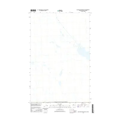
2017 Map of Bullfrog Mountain OE N
USGS Topo · Published 2017About this map
The international boundary of Canada/United States of America defines the southern edge of this map, reflecting the geopolitical division across the Okanagan-Similkameen region. This 2017 study captures a primarily natural landscape north of the border, where the terrain is marked by intricate hydrography including various lakes and complex drainage patterns. The absence of dense road networks or established settlements within this specific quadrangle suggests a region largely dedicated to conservation, rural land use, or natural resource management. By examining the detailed contours and water features, one can observe how the landscape's natural elevation and hydrology dictated historical land use patterns in this borderland area of British Columbia.
Find a feature on this map
1 named feature on this map. Tap any name to fly to it.
Don’t see what you’re looking for? This feature index may not catch every label — zoom into the map to look around manually.
Map Details
Editions of this 2017 Bullfrog Mountain OE N Map
This is the sole edition of this map. No revisions or reprints were ever made.
Other maps of this area

1902 · Osoyoos
USGS Topo · 1:125,000

1904 · Osoyoos
USGS Topo · 1:125,000

1906 · Chopaka
USGS Topo · 1:125,000

1954 · Okanogan
USGS Topo · 1:250,000

1956 · Loomis
USGS Topo · 1:62,500

1957 · Oroville
USGS Topo · 1:62,500

1958 · Okanogan
USGS Topo · 1:250,000

1975 · Oroville NW
USGS Topo · 1:24,000
1981 · Nighthawk
USGS Topo · 1:24,000
1982 · Oroville
USGS Topo · 1:24,000