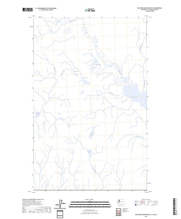
2023 Map of Bullfrog Mountain OE N
USGS Topo · Published 2023About this map
Osoyoos Lake and the meandering Okanagan River dominate the eastern reaches of this Okanogan County landscape, marking a vital hydrological corridor near the international boundary. The terrain is defined by a series of distinct water bodies that suggest a complex geological and drainage history, from the prominent Spotted Lake and Deadman Lake in the north to Kilpoola Lake and Blue Lake further south. Numerous seasonal and perennial drainages, including Testalinden Creek, Conifryd Creek, and Strawberry Creek, carve through the elevations, feeding into the primary river system or collecting in isolated basins. The absence of dense settlement on this map highlights the area's character as a managed natural environment, where the topography is shaped by the Lone Pine Creek watershed and the broad expanses of Richter Lake and Conifryd Lake.
Find a feature on this map
14 named features on this map. Tap any name to fly to it.
Don’t see what you’re looking for? This feature index may not catch every label — zoom into the map to look around manually.
Map Details
Editions of this 2023 Bullfrog Mountain OE N Map
This is the sole edition of this map. No revisions or reprints were ever made.
Other maps of this area

1902 · Osoyoos
USGS Topo · 1:125,000

1904 · Osoyoos
USGS Topo · 1:125,000

1906 · Chopaka
USGS Topo · 1:125,000

1954 · Okanogan
USGS Topo · 1:250,000

1956 · Loomis
USGS Topo · 1:62,500

1957 · Oroville
USGS Topo · 1:62,500

1958 · Okanogan
USGS Topo · 1:250,000

1975 · Oroville NW
USGS Topo · 1:24,000
1981 · Nighthawk
USGS Topo · 1:24,000
1982 · Oroville
USGS Topo · 1:24,000