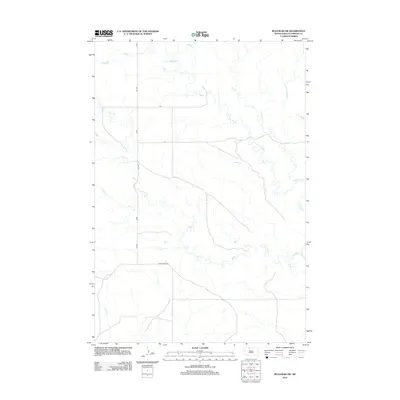
2012 Map of Bullhead SW
USGS Topo · Published 2012About this map
Iron Dog Creek and Stink Creek wind across this part of the Rock Creek District in Corson County, shaping a drainage landscape defined by low-lying waterways. The transport network in this rural South Dakota corridor is established by a grid of local routes, including 245 Ave and W Bullhead Road. These roads serve the expansive ranching or agricultural tracts common to the Standing Rock Reservation area, where the terrain rises and falls between the creek beds. The 2012 survey by the U.S. Geological Survey documents the placement of these essential rural thoroughfares such as cs4 alongside the natural hydrology of the plains, providing a record of the area's infrastructure and land use during the early 21st century.
Find a feature on this map
6 named features on this map. Tap any name to fly to it.
Don’t see what you’re looking for? This feature index may not catch every label — zoom into the map to look around manually.
Map Details
Editions of this 2012 Bullhead SW Map
This is the sole edition of this map. No revisions or reprints were ever made.
Other maps of this area

1953 · McIntosh
USGS Topo · 1:250,000

1956 · Black Horse NE
USGS Topo · 1:24,000

1956 · Bullhead
USGS Topo · 1:24,000

1956 · Miscol
USGS Topo · 1:24,000

1956 · Bullhead SW
USGS Topo · 1:24,000

1956 · Miscol NE
USGS Topo · 1:24,000

1958 · McIntosh
USGS Topo · 1:250,000

1972 · Walker
USGS Topo · 1:24,000
1972 · McIntosh SE
USGS Topo · 1:24,000

1972 · McIntosh
USGS Topo · 1:24,000