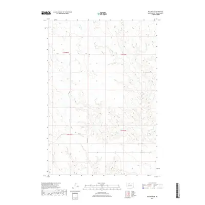
2017 Map of Bullhead SW
USGS Topo · Published 2017About this map
Stink Cr and Iron Dog Cr carve a complex network of drainage across this section of Corson County, shaping the landscape of the Rock Creek District. This 2017 survey by the U.S. Geological Survey captures the wide-open prairie and plateau country just before it transitions toward the Grand River valley. The terrain is marked by a sparse but essential road network, including the east-west passage of W Bullhead Rd and Co Rd 4, which connect the isolated homesteads and ranch lands of North Dakota's southern borderlands. Much of the map is defined by the high, dry breaks between the creeks, with Co Rd 718 and 107th St providing the primary access through the northern reaches of Township 22 North.
Find a feature on this map
10 named features on this map. Tap any name to fly to it.
Don’t see what you’re looking for? This feature index may not catch every label — zoom into the map to look around manually.
Map Details
Editions of this 2017 Bullhead SW Map
This is the sole edition of this map. No revisions or reprints were ever made.
Other maps of this area

1953 · McIntosh
USGS Topo · 1:250,000

1956 · Black Horse NE
USGS Topo · 1:24,000

1956 · Bullhead
USGS Topo · 1:24,000

1956 · Miscol
USGS Topo · 1:24,000

1956 · Bullhead SW
USGS Topo · 1:24,000

1956 · Miscol NE
USGS Topo · 1:24,000

1958 · McIntosh
USGS Topo · 1:250,000

1972 · Walker
USGS Topo · 1:24,000
1972 · McIntosh SE
USGS Topo · 1:24,000

1972 · McIntosh
USGS Topo · 1:24,000