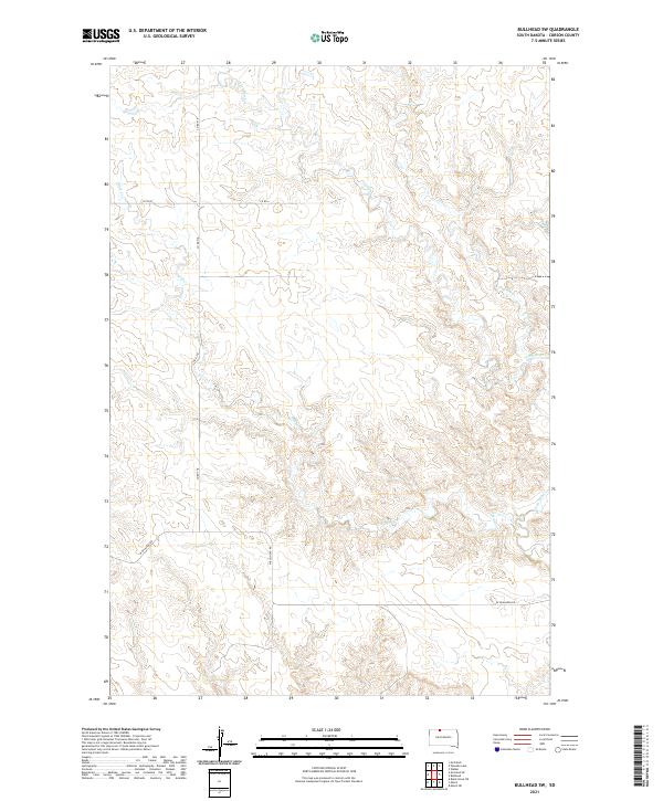
2021 Map of Bullhead SW
USGS Topo · Published 2021About this map
Iron Dog Creek and Stink Creek define the drainage patterns of this rural landscape in the Standing Rock Reservation area of northern South Dakota. The terrain is characterized by dissected plateaus and seasonal watercourses, where the upland prairie meets complex coulees. Transportation in this section of Corson County is managed through a sparse network of section-line roads, including Co Rd 718, Co Rd 4, and W Bullhead Rd, which connect the remote grazing lands and homesteads. The map illustrates the fundamental Public Land Survey System grid, specifically the intersection of Townships 21 and 22 North across Ranges 23 and 24 East, providing a precise spatial framework for land ownership and cattle ranching operations in this open country.
Find a feature on this map
10 named features on this map. Tap any name to fly to it.
Don’t see what you’re looking for? This feature index may not catch every label — zoom into the map to look around manually.
Map Details
Editions of this 2021 Bullhead SW Map
This is the sole edition of this map. No revisions or reprints were ever made.
Other maps of this area

1953 · McIntosh
USGS Topo · 1:250,000

1956 · Black Horse NE
USGS Topo · 1:24,000

1956 · Bullhead
USGS Topo · 1:24,000

1956 · Miscol
USGS Topo · 1:24,000

1956 · Bullhead SW
USGS Topo · 1:24,000

1956 · Miscol NE
USGS Topo · 1:24,000

1958 · McIntosh
USGS Topo · 1:250,000

1972 · Walker
USGS Topo · 1:24,000
1972 · McIntosh SE
USGS Topo · 1:24,000

1972 · McIntosh
USGS Topo · 1:24,000