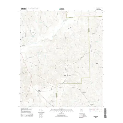
2014 Map of Bullock
USGS Topo · Published 2014About this map
The Conecuh River meanders through the heart of this landscape, defining the rural character of southeastern Alabama where the borders of Crenshaw, Coffee, and Pike counties converge. Smaller settlements like Bullock and Weed Crossroad serve as local anchors, connected by historic routes such as the Old Three Notch Rd. The area is densely patterned with water features and small impoundments, including Wallaces Pond and Bailey Lakes, which reflect the region's agricultural and milling history.
Find a feature on this map
75 named features on this map. Tap any name to fly to it.
Don’t see what you’re looking for? This feature index may not catch every label — zoom into the map to look around manually.
Map Details
Editions of this 2014 Bullock Map
This is the sole edition of this map. No revisions or reprints were ever made.
Other maps of this area

1953 · Andalusia
USGS Topo · 1:250,000

1957 · Andalusia
USGS Topo · 1:250,000

1968 · Danleys Crossroads
USGS Topo · 1:24,000
1968 · Goshen
USGS Topo · 1:24,000
1968 · Bluff Springs
USGS Topo · 1:24,000

1968 · Glenwood
USGS Topo · 1:24,000
1968 · Elba
USGS Topo · 1:24,000

1968 · Bullock
USGS Topo · 1:24,000

1971 · Dozier
USGS Topo · 1:24,000

1971 · Luverne
USGS Topo · 1:24,000