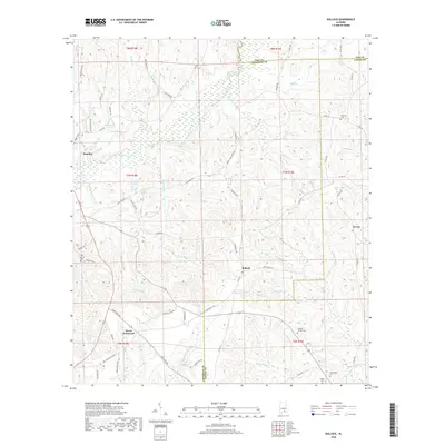
2018 Map of Bullock
USGS Topo · Published 2018About this map
Conecuh River headwaters wind through the landscape where the borders of Crenshaw, Pike, and Coffee Counties converge. This 2018 survey documents a region defined by small rural hubs and agricultural land, centered around the incorporated town of Brantley and the crossroads at Bullock. The terrain is etched with numerous family-named landmarks and watercourses, such as Honey Jones Mill Cr and Lightwood Knot Cr, suggesting a history of local milling and early settler landholdings.
Find a feature on this map
82 named features on this map. Tap any name to fly to it.
Don’t see what you’re looking for? This feature index may not catch every label — zoom into the map to look around manually.
Map Details
Editions of this 2018 Bullock Map
This is the sole edition of this map. No revisions or reprints were ever made.
Other maps of this area

1953 · Andalusia
USGS Topo · 1:250,000

1957 · Andalusia
USGS Topo · 1:250,000

1968 · Danleys Crossroads
USGS Topo · 1:24,000
1968 · Goshen
USGS Topo · 1:24,000
1968 · Bluff Springs
USGS Topo · 1:24,000

1968 · Glenwood
USGS Topo · 1:24,000
1968 · Elba
USGS Topo · 1:24,000

1968 · Bullock
USGS Topo · 1:24,000

1971 · Dozier
USGS Topo · 1:24,000

1971 · Luverne
USGS Topo · 1:24,000