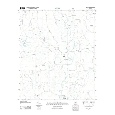
2011 Map of Bulls Gap
USGS Topo · Published 2011About this map
Pierces Mill and the small settlements of Brownsville and East Mill anchor the southern reaches of this Clay County landscape, where the waters of Hatchet Creek and Little Hatchet Creek converge. The terrain is defined by low ridges like McGehee Mountain and the prominent Hollins Fire Tower, which overlooks the Hollins Wildlife Camping Area. This region preserves a dense network of family and community landmarks, evidenced by numerous burial grounds such as the Rozelle and Chandler Cemetery, Russell Cemetery, and Campbell Cemetery. Settlement patterns follow the winding paths of rural routes like Horns Valley Rd and Shady Grove Rd, connecting dispersed hamlets including Roselle, Bulls Gap, and Shady Grove. The map provides a clear record of the area's spiritual and civic foundations at Bethlehem Church and the Marvin Chapel Cemetery.
Find a feature on this map
50 named features on this map. Tap any name to fly to it.
Don’t see what you’re looking for? This feature index may not catch every label — zoom into the map to look around manually.
Map Details
Editions of this 2011 Bulls Gap Map
This is the sole edition of this map. No revisions or reprints were ever made.
Other maps of this area

1890 · Talladega
USGS Topo · 1:125,000

1891 · Ashland
USGS Topo · 1:125,000

1892 · Talladega
USGS Topo · 1:125,000

1943 · Talladega
USGS Topo · 1:62,500

1944 · Goodwater
USGS Topo · 1:62,500

1946 · Talladega
USGS Topo · 1:62,500

1947 · Goodwater
USGS Topo · 1:62,500

1953 · Birmingham
USGS Topo · 1:250,000

1953 · Atlanta
USGS Topo · 1:250,000

1956 · Birmingham
USGS Topo · 1:250,000