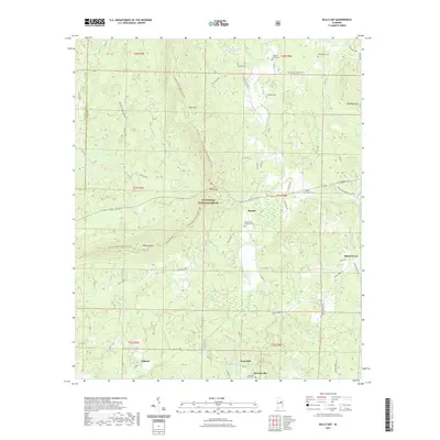
2021 Map of Bulls Gap
USGS Topo · Published 2021About this map
Talladega National Forest dominates the central landscape of this survey, where the ridges of Horn Mtn and Rebecca Mtn rise above the surrounding valleys. The terrain is defined by the headwaters of Hatchet Creek, which flows south through the quadrangle alongside numerous smaller tributaries like Moss Rock Br and Little Hatchet Cr. This modern data reflects a region where small, dispersed settlements like Roselle and Shady Grove are connected by a network of rural routes including Shady Grove Rd and State Rte 148. Numerous family and community burial grounds, such as the Rozelle and Chandler Cem and Russell Cem, are preserved across the ridges, offering significant data for those tracing local lineages. The presence of the Pinhoti National Recreation Trail following the high ground of the mountains underscores the area's transition into a protected recreational landscape.
Find a feature on this map
61 named features on this map. Tap any name to fly to it.
Don’t see what you’re looking for? This feature index may not catch every label — zoom into the map to look around manually.
Map Details
Editions of this 2021 Bulls Gap Map
This is the sole edition of this map. No revisions or reprints were ever made.
Other maps of this area

1890 · Talladega
USGS Topo · 1:125,000

1891 · Ashland
USGS Topo · 1:125,000

1892 · Talladega
USGS Topo · 1:125,000

1943 · Talladega
USGS Topo · 1:62,500

1944 · Goodwater
USGS Topo · 1:62,500

1946 · Talladega
USGS Topo · 1:62,500

1947 · Goodwater
USGS Topo · 1:62,500

1953 · Birmingham
USGS Topo · 1:250,000

1953 · Atlanta
USGS Topo · 1:250,000

1956 · Birmingham
USGS Topo · 1:250,000