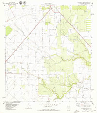
1979 Map of Bullshead Creek
USGS Topo · Published 1979About this map
The Southern Pacific railroad cuts diagonally across this South Texas landscape, serving as the primary industrial artery near the settlement of Tynan. The terrain is defined by a complex network of drainage systems, including Bullshead Creek and Papalote Creek, which cross the undulating plains alongside Mc Fall Creek and Ratta Creek. The presence of an Indefinite Boundary near the Bee Co San Patricio Co line suggests the complex history of local surveying and jurisdictional transitions in this region during the late 1970s.
Find a feature on this map
14 named features on this map. Tap any name to fly to it.
Don’t see what you’re looking for? This feature index may not catch every label — zoom into the map to look around manually.
Map Details
Editions of this 1979 Bullshead Creek Map
This is the sole edition of this map. No revisions or reprints were ever made.
Other maps of this area

1927 · Mathis
USGS Topo · 1:62,500

1953 · Beeville
USGS Topo · 1:250,000

1954 · Skidmore
USGS Topo · 1:62,500

1954 · Fleming
USGS Topo · 1:62,500

1954 · Mathis
USGS Topo · 1:62,500

1954 · Sinton
USGS Topo · 1:62,500

1956 · Beeville
USGS Topo · 1:250,000

1960 · Beeville
USGS Topo · 1:250,000

1979 · Burkes Ridge
USGS Topo · 1:24,000
1979 · Sinton West
USGS Topo · 1:24,000