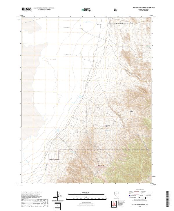
2021 Map of Bullwhacker Springs
USGS Topo · Published 2021About this map
Bullwhacker Springs and a series of high-desert water sources define this transition between the arid Railroad Valley floor and the steep slopes of the Grant Range. The terrain rises sharply from Bacon Flat into the protected lands of the Humboldt National Forest, where deep incisions like Heath Canyon and Irwin Canyon cut through the limestone and dolomite peaks. This 2021 survey documents the essential hydrology of the region, noting critical points such as Thorn Spring, Willow Springs, and Mud Spring. Access to this remote Nye County landscape is preserved via the Natl Forest Develop Road 421 Rd and Midland Trail Rd, routes that follow the ancient natural corridors used by early travelers through the basin and range province.
Find a feature on this map
27 named features on this map. Tap any name to fly to it.
Don’t see what you’re looking for? This feature index may not catch every label — zoom into the map to look around manually.
Map Details
Editions of this 2021 Bullwhacker Springs Map
This is the sole edition of this map. No revisions or reprints were ever made.
Other maps of this area

1956 · Lund
USGS Topo · 1:250,000

1960 · Lund
USGS Topo · 1:250,000

1964 · Blue Eagle Springs
USGS Topo · 1:62,500

1964 · Currant
USGS Topo · 1:62,500

1964 · Troy Canyon
USGS Topo · 1:62,500

1964 · Forest Home
USGS Topo · 1:62,500

1980 · Duckwater
USGS Topo · 1:100,000

1988 · Quinn Canyon Range
USGS Topo · 1:100,000
1990 · Troy Canyon
USGS Topo · 1:24,000
1990 · Blue Eagle Mountain
USGS Topo · 1:24,000