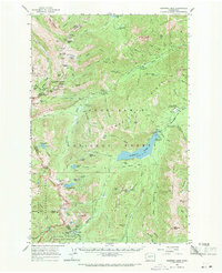
1962 Map of Bumping Lake
USGS Topo · Published 1971About this map
Goose Prairie serves as a central hub in this high-altitude landscape where the Bumping River meets the expansive Bumping Lake reservoir. The map documents a transition in land use, showing both the remnants of mining history at Copper City and the development of recreational infrastructure within the Snoqualmie National Forest. To the west, the Cascade Crest Trail follows the high ridges along the border of Mount Rainier National Park, passing notable landmarks like Pickhandle Point and Sourdough Gap. The engineering of the watershed is evidenced by the Bumping Lake Dam and various hydrological installations, including a Gaging Station and intake, while the numerous campgrounds like Lodgepole Campground and Camp Fife reflect the area's mid-century role as a destination for outdoor enthusiasts and youth organizations.
Find a feature on this map
127 named features on this map. Tap any name to fly to it.
Don’t see what you’re looking for? This feature index may not catch every label — zoom into the map to look around manually.
Map Details
Editions of this 1962 Bumping Lake Map

Other maps of this area

1901 · Snoqualmie Pass
USGS Topo · 1:125,000

1902 · Mount Aix
USGS Topo · 1:125,000

1903 · Snoqualmie
USGS Topo · 1:125,000

1904 · Mt Aix
USGS Topo · 1:125,000

1913 · Cedar Lake
USGS Topo · 1:125,000

1924 · Mt Rainier
USGS Topo · 1:96,000

1928 · Mt Rainier
USGS Topo · 1:125,000

1950 · Yakima
USGS Topo · 1:250,000

1956 · Greenwater
USGS Topo · 1:62,500

1957 · Wenatchee
USGS Topo · 1:250,000