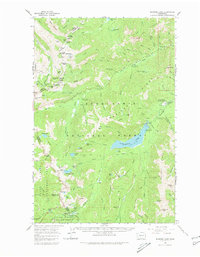
1962 Map of Bumping Lake
USGS Topo · Published 1980About this map
Bumping Lake and the high ridges of the Cascades dominate this early 1960s survey of the Snoqualmie National Forest. The map documents a landscape of high-elevation recreation and resource extraction, where the Goose Prairie post office serves as a hub for the remote area. Evidence of the region's mining history is scattered across the peaks, notably at the Blue Bell Mine and the historical location of Copper City.
Find a feature on this map
113 named features on this map. Tap any name to fly to it.
Don’t see what you’re looking for? This feature index may not catch every label — zoom into the map to look around manually.
Map Details
Editions of this 1962 Bumping Lake Map

Other maps of this area

1901 · Snoqualmie Pass
USGS Topo · 1:125,000

1902 · Mount Aix
USGS Topo · 1:125,000

1903 · Snoqualmie
USGS Topo · 1:125,000

1904 · Mt Aix
USGS Topo · 1:125,000

1913 · Cedar Lake
USGS Topo · 1:125,000

1924 · Mt Rainier
USGS Topo · 1:96,000

1928 · Mt Rainier
USGS Topo · 1:125,000

1950 · Yakima
USGS Topo · 1:250,000

1956 · Greenwater
USGS Topo · 1:62,500

1957 · Wenatchee
USGS Topo · 1:250,000