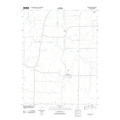
2011 Map of Bunceton
USGS Topo · Published 2011About this map
Bunceton anchors this central Cooper County landscape, situated where the terrain transitions toward the West Central Loess Hills. The 2011 survey reveals a settlement pattern largely defined by its watercourses, with Petite Saline Creek and Stephens Branch carving through the agricultural tablelands. Small rural hubs like Speed and Bellair persist along a network of local roads such as New Palestine Rd and Old Concord Dr. For genealogists and local historians, the map provides precise locations for several community landmarks, including Concord Cemetery, Briscoe Cemetery, and Masonic Cemetery. The drainage patterns of Coalbank Creek and Hutchison Branch illustrate the area's natural topography, showing how the local road system, including routes like Osage Valley Rd, adapts to the creek-fed valleys of the Missouri interior.
Find a feature on this map
34 named features on this map. Tap any name to fly to it.
Don’t see what you’re looking for? This feature index may not catch every label — zoom into the map to look around manually.
Map Details
Editions of this 2011 Bunceton Map
This is the sole edition of this map. No revisions or reprints were ever made.
Other maps of this area

1888 · Boonville
USGS Topo · 1:125,000

1947 · Jefferson City
USGS Topo · 1:250,000

1952 · Boonville
USGS Topo · 1:24,000

1952 · Tipton
USGS Topo · 1:24,000
1952 · Clarksburg
USGS Topo · 1:24,000

1952 · Lone Elm
USGS Topo · 1:24,000

1953 · Billingsville
USGS Topo · 1:24,000

1953 · Pilot Grove North
USGS Topo · 1:24,000

1953 · Pilot Grove South
USGS Topo · 1:24,000
1953 · Bunceton
USGS Topo · 1:24,000