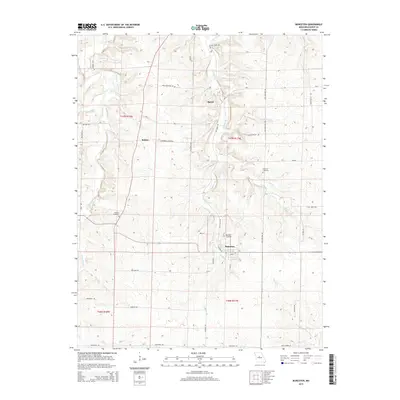
2015 Map of Bunceton
USGS Topo · Published 2015About this map
Bunceton sits at the heart of this Cooper County landscape, serving as a central hub for a network of country roads and agricultural lands. The terrain is defined by a dense system of waterways, most notably Petite Saline Cr and Stephens Br, which carve through the township boundaries of t47n r18w and t47n r17w. Smaller settlements like Speed and Bellair punctuate the rural intersections, connected by named thoroughfares such as New Palestine Rd and Leonard Cutoff Rd.
Find a feature on this map
43 named features on this map. Tap any name to fly to it.
Don’t see what you’re looking for? This feature index may not catch every label — zoom into the map to look around manually.
Map Details
Editions of this 2015 Bunceton Map
This is the sole edition of this map. No revisions or reprints were ever made.
Other maps of this area

1888 · Boonville
USGS Topo · 1:125,000

1947 · Jefferson City
USGS Topo · 1:250,000

1952 · Boonville
USGS Topo · 1:24,000

1952 · Tipton
USGS Topo · 1:24,000
1952 · Clarksburg
USGS Topo · 1:24,000

1952 · Lone Elm
USGS Topo · 1:24,000

1953 · Billingsville
USGS Topo · 1:24,000

1953 · Pilot Grove North
USGS Topo · 1:24,000

1953 · Pilot Grove South
USGS Topo · 1:24,000
1953 · Bunceton
USGS Topo · 1:24,000