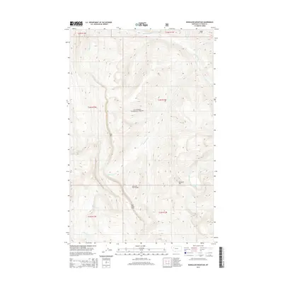
2014 Map of Bungalow Mountain
USGS Topo · Published 2014About this map
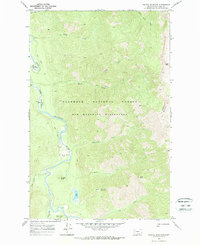
The Flathead National Forest defines this high-elevation landscape, where the Lewis and Clark Range creates a formidable vertical profile. Steep drainages and ridges dominate the terrain, notably the massive Wall Creek Cliffs and peaks like Ibex Mtn and Bungalow Mtn. The hydrology of the area is shaped by the Spotted Bear River and the White River, fed by numerous high-country tributaries such as W Fork Wall Cr and Juliet Cr. This 2014 survey documents a wilderness environment largely devoid of human settlements, focusing instead on the complex topography of the Continental Divide region. Researchers can trace the path of Christopher Cr as it flows from Christopher Lake, or locate family-named features like Rooney Cr and Hart Cr that mark this portion of Flathead County.
Find a feature on this map
26 named features on this map. Tap any name to fly to it.
Don’t see what you’re looking for? This feature index may not catch every label — zoom into the map to look around manually.
Map Details
Editions of this 2014 Bungalow Mountain Map
This is the sole edition of this map. No revisions or reprints were ever made.
Other maps of this area

1936 · Silvertip
USGS Topo · 1:96,000

1942 · Silvertip
USGS Topo · 1:125,000

1955 · Choteau
USGS Topo · 1:250,000

1957 · Choteau
USGS Topo · 1:250,000

1958 · Choteau
USGS Topo · 1:250,000

1962 · Choteau
USGS Topo · 1:250,000
1970 · Cathedral Peak
USGS Topo · 1:24,000
1970 · Whitcomb Peak
USGS Topo · 1:24,000
1970 · Trilobite Peak
USGS Topo · 1:24,000
1970 · Pagoda Mountain
USGS Topo · 1:24,000