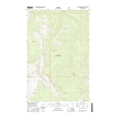
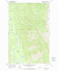
2017 Map of Bungalow Mountain
USGS Topo · Published 2017About this map
Flathead National Forest covers this stretch of the Lewis and Clark Range in western Montana, where dramatic elevation changes define the landscape. High peaks such as Bungalow Mtn and Silvertip Mtn tower over the drainage basins of the Spotted Bear River and its numerous tributaries. The topography is marked by steep drops at the Wall Creek Cliffs and several smaller mountain summits including Ibex Mtn and Table Hill. A complex network of watercourses, including W Fork Wall Cr, Christopher Cr, and Silvertip Cr, carve through the terrain, illustrating the hydrologic patterns of this high-altitude wilderness. This 2017 survey reflects the preserved nature of the forest, showing no permanent settlements but highlighting the named geographic features that have guided travelers and foresters through these mountains for generations.
Find a feature on this map
20 named features on this map. Tap any name to fly to it.
Don’t see what you’re looking for? This feature index may not catch every label — zoom into the map to look around manually.
Map Details
Editions of this 2017 Bungalow Mountain Map
This is the sole edition of this map. No revisions or reprints were ever made.
Other maps of this area

1936 · Silvertip
USGS Topo · 1:96,000

1942 · Silvertip
USGS Topo · 1:125,000

1955 · Choteau
USGS Topo · 1:250,000

1957 · Choteau
USGS Topo · 1:250,000

1958 · Choteau
USGS Topo · 1:250,000

1962 · Choteau
USGS Topo · 1:250,000
1970 · Cathedral Peak
USGS Topo · 1:24,000
1970 · Whitcomb Peak
USGS Topo · 1:24,000
1970 · Trilobite Peak
USGS Topo · 1:24,000
1970 · Pagoda Mountain
USGS Topo · 1:24,000