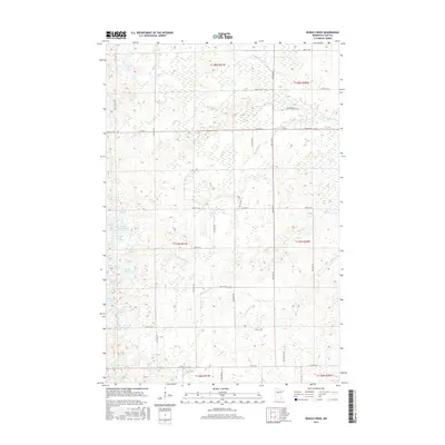
2016 Map of Bungo Creek
USGS Topo · Published 2016About this map
Bungo Creek meanders through a labyrinth of wetlands and glacial lakes in this 2016 study of Cass County. The landscape is defined by its complex hydrography, where the S Fork Pine River and Brittan Cr weave through extensive marshlands like the Rice Lake Swamp. A dense cluster of named water bodies, including Cedar Lake, Hunter Lake, and Lehman Lake, suggests a region where the terrain is dominated more by water and peat than by traditional settlement. Transportation is limited to a grid of rural routes such as Co Hwy 2 and Bungo Creek Dr SW, which navigate around the natural barriers of Hazelnut Lake and Deep Lake. This map captures the area as a preserved aquatic corridor, highlighting the intricate drainage patterns of Wilson Cr and Hoblin Cr that feed into the larger river systems of northern Minnesota.
Find a feature on this map
45 named features on this map. Tap any name to fly to it.
Don’t see what you’re looking for? This feature index may not catch every label — zoom into the map to look around manually.
Map Details
Editions of this 2016 Bungo Creek Map
This is the sole edition of this map. No revisions or reprints were ever made.
Other maps of this area

1919 · Leader
USGS Topo · 1:62,500

1953 · Brainerd
USGS Topo · 1:250,000

1957 · Brainerd
USGS Topo · 1:250,000

1958 · Brainerd
USGS Topo · 1:250,000

1959 · Pine River
USGS Topo · 1:24,000

1959 · Pine River SW
USGS Topo · 1:24,000

1965 · Brainerd
USGS Topo · 1:250,000

1970 · Spider Lake
USGS Topo · 1:24,000

1970 · Backus
USGS Topo · 1:24,000
1970 · Bungo Creek
USGS Topo · 1:24,000