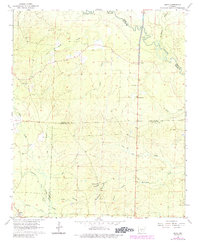
1964 Map of Bunn
USGS Topo · Published 1984About this map
The Saline River and its dense network of tributaries, including Hurricane Creek and Moro Creek, define the topography of this South Arkansas borderland during the mid-1960s. This survey records a landscape where Dallas, Grant, and Cleveland counties meet, marked by timber-linked settlements like Bunn and Farindale. The mapping reveals a rural social geography centered around small community hubs such as Shady Grove Ch and Lee Ridge Ch. Genealogists will find particular value in the distribution of family and community burial grounds, with Hardcastle Cem, Hampton Springs Cem, Harrison Cem, and Wright Cem all clearly identified. The presence of a Gravel Pit and numerous logging-era roads suggests the local resource-based economy, while the intricate system of small waterways like Schoolhouse Branch and Cold Branch shows the natural drainage patterns of this heavily wooded river valley.
Find a feature on this map
27 named features on this map. Tap any name to fly to it.
Don’t see what you’re looking for? This feature index may not catch every label — zoom into the map to look around manually.
Map Details
Editions of this 1964 Bunn Map
3 editions found

Other maps of this area

1903 · Camden
USGS Topo · 1:125,000

1953 · El Dorado
USGS Topo · 1:250,000

1955 · Little Rock
USGS Topo · 1:250,000

1956 · Little Rock
USGS Topo · 1:250,000

1957 · El Dorado
USGS Topo · 1:250,000

1958 · El Dorado
USGS Topo · 1:250,000

1960 · El Dorado
USGS Topo · 1:250,000

1960 · Little Rock
USGS Topo · 1:250,000

1964 · Little Rock
USGS Topo · 1:250,000

1964 · Staves
USGS Topo · 1:24,000